NASA

NIMBUS TO NOW
The History of NASA's Earth Observation Technology
By: Yong Liu, Jessica Xue, Alan Zheng, Edward Zhong


NASA stands for the National Aeronautics and Space Administration
NASA is a United States government agency responsible for space exploration, space technology, and aeronautics research. NASA's mission is to explore the unknowns of space, innovate for the benefit of humanity, and inspire the world through discovery. Since its founding in 1958, NASA has drastically improved its technology, which is shown through the evolution of NASA's Earth observing missions.
NASA's goal with the Nimbus
The goal of the Nimbus satellite technology program was to create an observation system that allowed Earth's scientists to be supported in their needs for their developments and studies.
THE PURPOSE OF NASA
Nimbus 1
Launch: August 28, 1964
Purpose: To assess a high-resolution infrared radiometer (HRIR) system for nighttime cloud-cover observation and an advanced vidicon camera system (AVCS) for daytime cloud coverage in order to offer better photos of local cloud conditions.
Impact: Provided the first worldwide view of clouds clearly and significant weather systems for meteorologists.
Nimbus 2
Launch: May 15, 1966
Purpose: to act as a stable, earth-centered platform for the collection of meteorological data and the testing of cutting-edge sensor systems.
Impact: Ocean temperature could be monitored thanks to newly designed sensors.
Nimbus B
Launch: May 18, 1968
Purpose: The primary purposes of Nimbus B were to test cutting-edge equipment and to find and gather meteorological data. The three main structural components of it are the sensor mount, solar pads, and control housing unit.
Impact: The Nimbus never achieved orbit because of a booster guidance system malfunction. However, it allowed NASA to learn from the mistake and successfully, create a working Nimbus less than a year later.
Nimbus 3
Launched: April 14, 1969
Purpose: Nimbus 3, a successor for Nimbus B
Impact: It was NASA's first successful launch utilizing nuclear power in orbit. Additionally, it was the first weather satellite.
Nimbus 4
Launch: April 8, 1970
Purpose: In a series of second-generation meteorological research and development satellites, Nimbus 4 is the fourth one. It was built to act as a stable, earth-focused platform for the testing of cutting-edge meteorological sensor systems and for gathering meteorological data.
Impact: In the middle of the 1960s, Nimbus 4 gathered orbital data on the size of the polar caps, which were captured in the visible and infrared spectra. These first comprehensive images of the icecaps on Earth provide as crucial data points for research on climate change.
Nimbus 4 measured the total amount of ozone in the Earth’s atmosphere. This allows us to prevent health and environmental problem.
Nimbus 5
Launch: December 10, 1972
Purpose: The Nimbus 5 research and development satellite was created to act as an earth-focused, stable platform for the collecting of global-scale meteorological and geological data as well as the testing of new meteorological sensor systems.
Impact: Nimbus 5 allows us to see the change in the environment. It collects data of the clouds and Earth and shows us how it's changed.
Nimbus 6
Launch: June 12, 1975
Purpose: It served as a stabilized earth-oriented platform for testing advanced systems for sensing and collecting meteorological data on a global scale
Impact: The Nimbus 6 gave scientists the first satellite-based measurements of atmospheric temperature at different altitudes.
Nimbus 7
Launch: October 24, 1978
Purpose: The Nimbus 7 research-and-development satellite served as a stabilized, earth-oriented platform for the testing of advanced systems used to sense and collect data in the pollution, oceanographic, and meteorological disciplines.
Impact: The Nimbus 7 collected data on ozone, the stratosphere, ocean conditions, and global weather until 1994.
After the Nimbus


Hey guys and girls, we are the FaNASAtic four.
The Space Shuttle Program
Purpose: The Space Shuttle Program was conceived during the 1980s. It was envisioned to help advance human space exploration. It was also meant to complete the assembly of the International Space Station.
Impact: Aided in the construction of the Hubble Space Telescope, a multinational space facility that altered Earth's understanding of the universe's age and its vision of the cosmos. The astronauts from the shuttle launched it, repaired it, and improved it four more times while they were performing spacewalks.
Advancements: Its large cargo bay allowed for bigger payloads, and since it was reusable, it offered a more economic option for flying human spaceflight missions. It could also accommodate more crew members.
Launch date:
April 12, 1981

Space Shuttle Endeavor
Purpose: To fix and re-enter into orbit an information satellite (INTELSAT VI).
Impact: Opened up new potential applications for spaceborne imaging, including as natural hazard assessments, and provided information about the Earth's changing environment.
Advancements: One of several technical advancements made to Endeavour was the employment of a drag chute during a landing, making it the first Space Shuttle orbiter to do so. The Space Radar Laboratory, which contained the X-band Synthetic Aperture Radar and the Spaceborne Imaging Radar-C, was transported by the Space Shuttle Endeavor. With the first multi-frequency radar data sets from orbit, this was the most sophisticated civilian SAR yet created.
Launch date:
May 7, 1992

ISS-Rapidscat
Purpose: The NASA QuikScat Earth satellite instrument, which tracked ocean winds to give crucial observations needed in weather predictions, including hurricane tracking, was quickly and inexpensively replaced by the ISS-RapidScat sensor.
Impact: The data from ISS-RapidScat will help researchers contribute to an improved understanding of fundamental weather and climate processes, such as how tropical weather systems form and evolve
Advancements: Cost effective
Launch Date:
Sept. 21, 2014

Landsat 9
Purpose: In order to effectively track land use and document land change brought on by climate change, urbanization, drought, wildfire, biomass changes, and a host of other natural and human caused changes, Landsat satellites have the best ground resolution and spectral bands.
Impact: To gather priceless information about Earth below, Landsat 9 is equipped with two instruments that are comparable to those on Landsat 8. The Landsat spacecraft supplies the satellite with power, navigation, data storage, and other services. The Landsat 9 observatory is carrying on the tradition of 50 years of space-based Earth monitoring.
Advancement: Advanced equipments
Launch Date:
Sept. 27, 2021

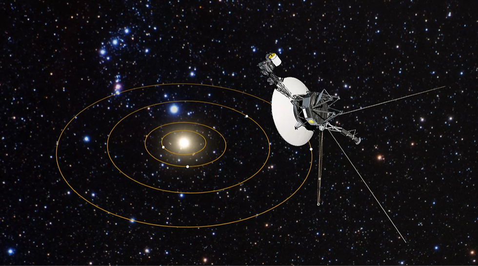
Voyager 1
Purpose: Voyager 1 was designed to take advantage of a rare planetary alignment to study the outer solar system up close.
Impact: Many moons surrounding the planets that we were unaware of were found by the Voyager spacecraft. Even the ones we were aware of before that were nothing more than light spots in telescopes.
Advancement: the UV spectrometer, the magnetometer, a charged particle detector, a cosmic ray detector, and the plasma wave system
Launch date:
September 5, 1977